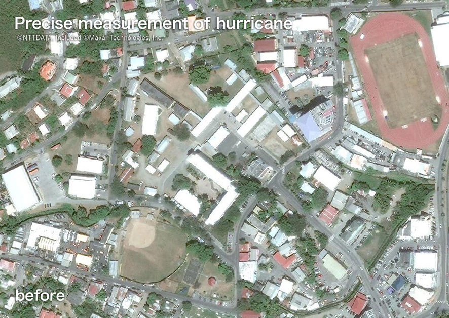
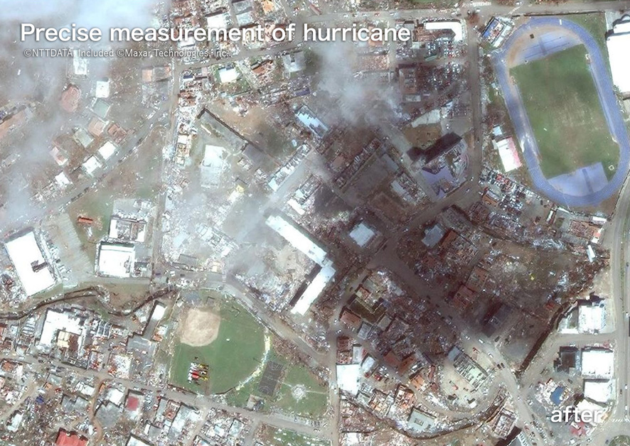
CONTACT US

3D Map Data in
flight simulators is critical;
is yours ready for take off?

AW3D provided High-accuracy, High-resolution 3D Map data
for flight simulation in order to ensure the aviation safety

SCROLL

Why we are chosen
by flight simulators
around the world?

Flight simulators are the last bastion of aviation safety.
Weather, topography, season, and missions…,
pilots are expected to perform at their best in all situations.
Therefore, the environment prepared for flight simulators must be highly accurate.AW3D can provide 3D map data
around the world for any simulators.

AW3D can provide 3D map data from around the world for any simulator, such as conflict areas or military operations planning.
AW3D supports strategic decisions for various users by providing high-quality, high-precision, and cost-effective digital elevation datasets.

Use cases

AW3D supports strategic decisions for various users by providing high-quality, high-precision,
and cost-effective digital elevation datasets.

Precise surveying of island near the border

CASE - 01

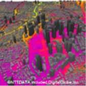
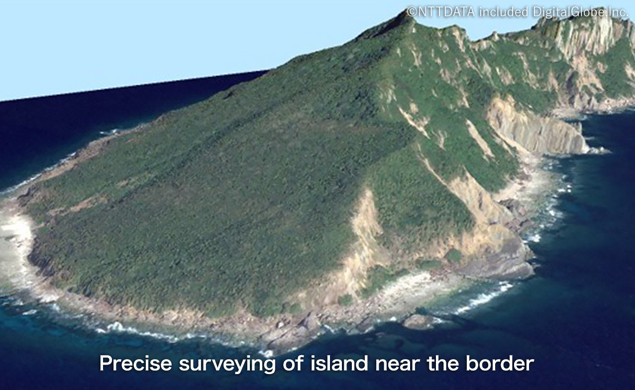
Situation awareness in conflict areas and strategic military sites

AW3D can provide highly accurate 3D data on sensitive areas such as conflict zones and national borders. These are used as basic information for topographic maps and military planning.
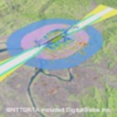
Plan to military operation

CASE - 02

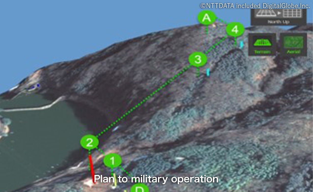
Military operations planning

AW3D provides detailed geological features and vegetation information for military operations such as driving routes for military vehicles, for planning fighter aircrafts . AW3D contributes to the planning of military operations on land, sea and air.

Flight simulation of takeoff and landing

CASE - 03

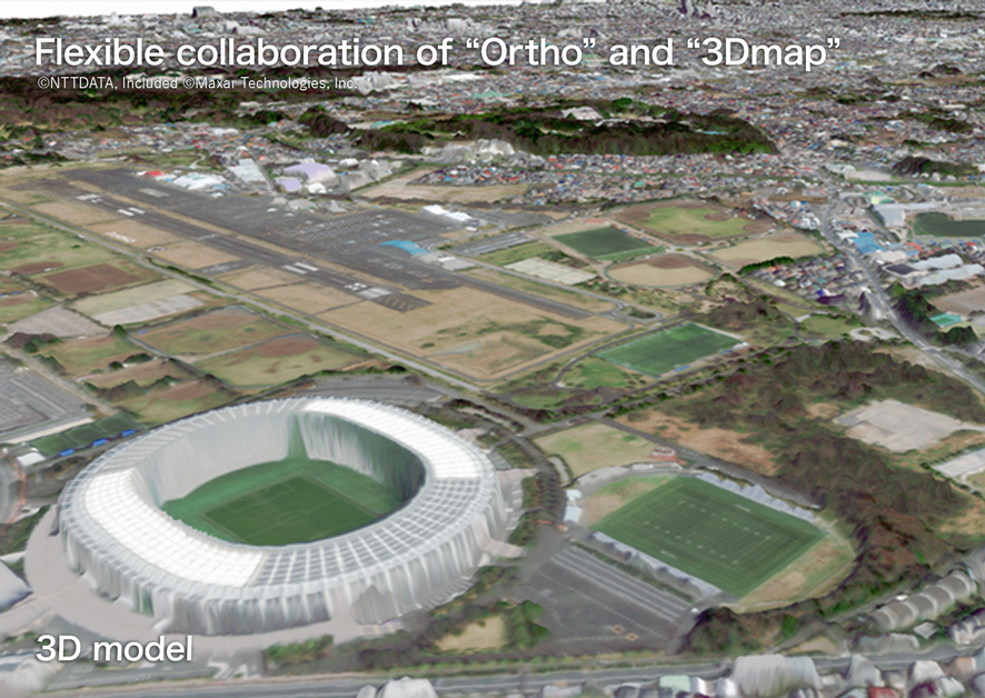
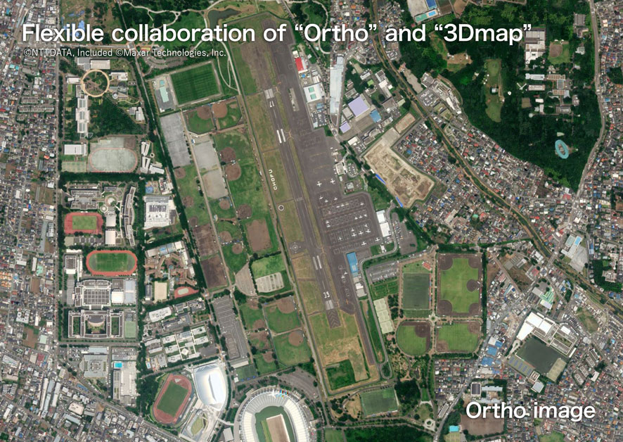
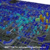
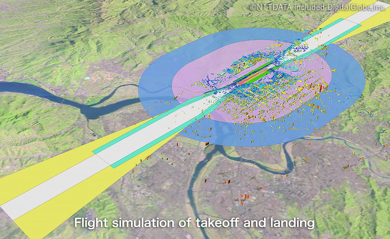
Flight simulation and
route planning

Extract possible risks by conducting detailed simulations of flight plans and march plans using AW3D. We can provide a highly realistic and highly reliable simulation environment, such as building heights, topographic undulations, flood conditions.

Features of AW3D

Before Image After Image

POINT - 01

Provide high-accuracy,
high-resolution 3D Maps globally

  • Get any locations you need in the world
  • Get areas where airplanes cannot fly
  • High accuracy and resolution (max:±50 cm)
  • No risk in taking satellite images
  • Available even for the denied areas
Before Image After Image

POINT - 02

Available to be offered
when necessary

  • Immediate collection when necessary
  • Quick response to emergencies
    e.g. disasters and military conflicts
  • Follow seasonal changes
  • Always up to date
Before Image After Image

POINT - 03

AW3D is cost effective and value for money

  • Only where you need it, with the accuracy and timeliness you need
  • Compatible with the creation of data from multiple sources
  • Flexible combination of different data
  • Choose the freshness and accuracy according to your usage
illustrations

“AW3D Suite” line-up

Depending on your usage, you can choose from different products.

AW3D
Standard
AW3D
Enhanced
AW3D
Building
AW3D
Ortho Image
AW3D
Telecom
AW3D
Airport
Data 2.5m/5m
DSM/DTM
0.5-2m
DSM/DTM
3D Building
Vector
Geometrically
Corrected imagery
3D package for
Data Set
3D package for
Airport
Characteristic Global coverage,
Short delivery,low price
Fresh data available,
High resolution
Hign accuracy,
Three-dimensional
High accuracy,
High resolution
3D dataset for
RF simulation
Aviation intemational
Standard complied
Usage Disaster prevention,
Construction sims,etc.
Scientific analysis,
Civil endineering, etc.
City planning,
etc.
Digital Mapping, Facility
management, etc.
Network Planning for
mobile operator,etc.
Electric terrain and
Obstacle data (eTOD) etc.
Product
Image
AW3D Product Image AW3D Product Image AW3D Product Image AW3D Product Image AW3D Product Image AW3D Product Image

Price

Compared to aerial photography, it offers great value for money.

AW3D Team photo

AW3D Team

The AW3D can help you find the best options.
We’ll design a solution for your business to help you
get the data for your business.

Contact us

For inquiries regarding this product, please contact us below.

NTT DATA RESTEC
Copyright© 2014 - 2023 NTT DATA CORPORATION and RESTEC. All Rights Reserved.